Справка по редактированию карт
Редактирование карты состоит из нескольких этапов, перечисленных ниже.
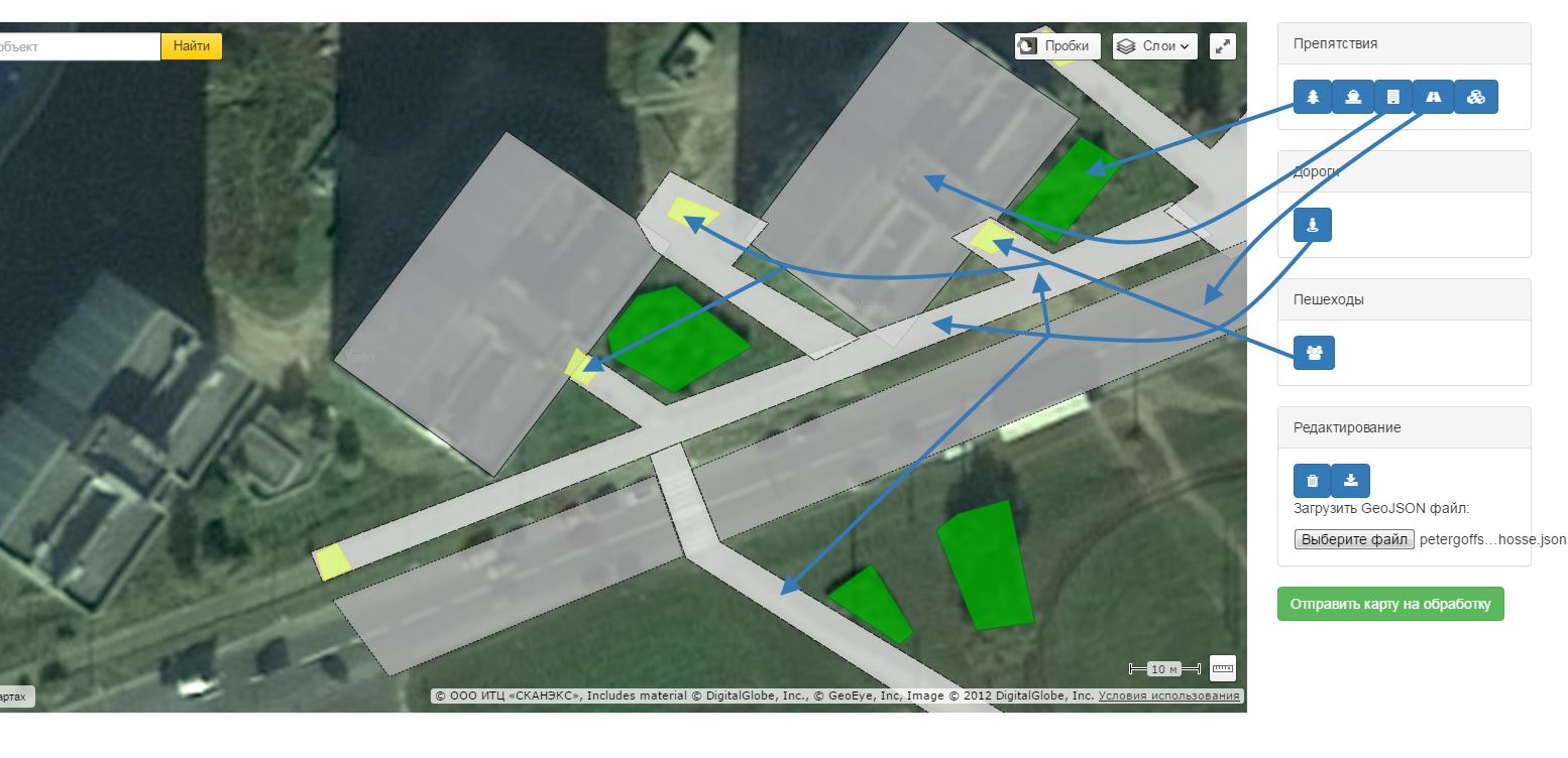
Для добавления объекта нужного типа нажмите кнопку на панели справа.

Этап первый: расстановка препятствий
Препятствия на карте бывают проходимыми и непроходимыми. Проходимые препятствия отмечены пунктирным контуром.
Типы препятствий:
-
Деревья и прочая растительность. Отмечены зеленым цветом. Люди не любят лазать через кусты, но в принципе способны это делать, если понадобится.
-
Водные преграды: реки, пруды. Непреодолимы для пешеходов, отмечены синим цветом.
-
Здания и прочие сооружения. Непреодолимы для пешеходов, отмечены темно-серым цветом.
-
Автомобильные дороги (сама проезжая часть без учета тротуаров). Пешеходы их избегают, но способны их пересекать.
-
Прочие препятствия. Любое непреодолимое препятствие, не попадающее под указанные выше категории.
Этап второй: пешеходные дорожки
Этап второй: пешеходные дорожки
Этап третий: генераторы пешеходов
Генераторы — это точки на карте, между которыми пешеходы передвигаются. Это могут быть подъезды домов, остановки транспорта или просто площадки с лавочками. Также как генераторы помечаются все дорожки, ведущие за пределы рассматриваемого района симуляции.
Добавляются на карту они с помощью инструмента
Этап четвертый: определение границ карты
Иногда случается так, что из-за отсутствия препятствий, окружающих рассматриваемый участок местности, пешеходы начинают находить новые маршруты и выходить за пределы анализируемой зоны. Чтобы избежать этого, можно вручную задать границы зоны симуляции с помощью элемента ""Граница"".
Отправка карты и получение результатов
Карту в любой момент можно скачать в формате GeoJSON с помощью кнопки
Когда редактирование завершено, нажмите зеленую кнопку для отправки карты на сервер. Вы получите ее уникальный ID. Введите этот ID в форму вверху, чтобы проверить состояние карты.
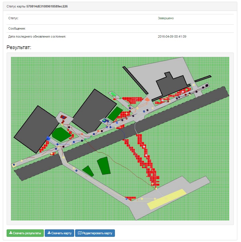
После завершения работы на этой странице можно будет увидеть результат. Красным цветом будут отмечены места, где, по прогнозу алгоритма, пешеходы будут ходить по газону.

Алгоритм верно определил основную проблему участка — тропы через широкий газон. Конкретные очертания и точное местоположение могут отличаться от реальности, это следствие неточности карты и случайности движения пешеходов. Однако данного результата уже достаточно для определения нуждающихся в доработке участков.
С помощью кнопок внизу можно скачать результат (картинку + json-описание карты в архиве) или вернуться к редактированию карты.